
Beacon Point (NZ317 894) to Lyne Burn mouth (NZ305 908)
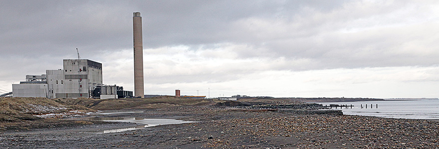
Looking North from the Beacons, the vista is dominated by Lynemouth power station beyond which lies Coquet Island and, on a clear day, Dunstanburgh Castle (25 miles away) can be seen shimmering in the heat.
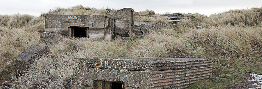
The coastal path continues north and passes the mound of the 5th Tee on the golf course. The path skirts around the disused quarry (home to a Desert Wheatear in the 2011/12 winter), to the sea side of a long mound which separates the path from the golf course leading to a network of World War 2 pillboxes (NZ314 895).

A Desert Wheatear
from the
Winter of 2011
by Jimmy Steele
Note: A pillbox is a reinforced concrete structure with embrasures affording both protection to the occupants (limited!) and a wide field of fire.
This particular group of pillboxes protected the open beach of Lynemouth Bay and forms part of a network on the Northumberland coast built as anti-invasion preparations in 1940.

A Desert Wheatear
Continuing Northwards, the path is less well defined (may change in 2017 with the New coastal path) and there is an option; walk through the dunes bordering the golf course or walk along the shoreline of Lynemouth beach. This is not a “pretty” beach as the sands sit beneath millions of tons of colliery waste and demolition/building rubble. It is probably the worst example of coastline pollution on the Northumberland coast. However, it is quite an isolated spot, only disturbed by dog walkers and anglers. Birds like it for that and it offers a roosting area at high tide for waders and is a magnet for Wheatears at times of passage. Since the closure of the collieries, the tides are slowly but surely sweeping the waste away and returning the beach to its natural state.
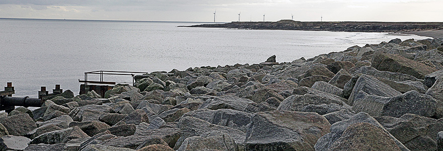
At the North end of the bay lies Lynemouth power station (converted to a biomass fired power station in 2017 and owned by Czech firm EPH). The path passes between the security fence of the power station and the armored sea defence wall built from huge, stone boulders. The sea defence system was constructed in 1994 after flooding due to freak high tides and strong winds. During falls of migrants, the sea wall is a magnet for Robins, Wheatears, Whinchats and Redstarts.

A Lapland Bunting
by Hector Galley
Note: This part of the site can be accessed by parking the car at the power station carpark (public access NZ303 901). Walk to the end of a short path which runs parallel to the access road to the ash lagoons and enter the links area next to some large, concrete blocks. Head towards the sea and you will intersect with the coastal path.
At the end of the sea defence wall, the path continues around the perimeter fence of the power station, eventually crossing over a small effluent outlet (to be bridged as part of the coastal path project 2017). This leads to another large area of colliery waste before reaching the mouth of Lyne burn. There is a small dene at this point composed of Bramble scrub and Willows which provides cover for migrants. This is the Northerly most point of the Natural Newbiggin area. There are plans afoot to open up access to this area from the North in 2017.